
10 Hikes You Should Definitely Try (but may not have heard about) in the Laurentians
- Our Green Backpack

- Nov 19, 2021
- 11 min read
Updated: Dec 6, 2021
You know those days, you want to get outside, maybe do a hike but don't know where to go? Here is a selection of 10 pretty awesome hikes that we did in the spectacular Laurentians of Quebec. During the month of May, 2021 we hiked a different trail every day in this incredible mountain region. There are hundreds of trails in the area. In order to make this challenge possible, we chose trails that were not too far from where we live. Of the 31 trails we did, some were better than others so we filtered out the best ones for you! Now that you've found these awesome spots...
grab your boots and enjoy!
The trails are waiting!
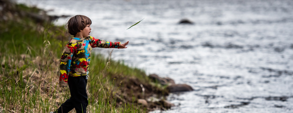
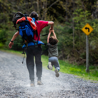
Note: All the information below is based upon our own experience walking and enjoying nature with our three-year old in tow. We walked slower, stopped more often and did the hikes at
our own family's pace. Trail level is also our subjective opinion - always know your own capabilities before embarking upon any trail. Lastly, trail conditions can vary as time passes. And yes, this is a disclaimer :)
1. Cordon Lake Tour Trail, Parc Éco Laurentides (CTEL)


Where in the World: Saint-Faustin-Lac-Carreé, QC, Canada
Name of the Trail: Les Refuges -->
Lake Tour --> Pine
Trail level: Moderate
Route Type: Loop
Length: 6.50 km
Time in nature: 3:31:20
Moving time: 1:36:32 - pace 14:51
Elevation gain: 160m
Altitude: From 347m to 397m


Trail Conditions: - well maintained
- maps along the way
- bridges along the path
- muddy
- lake views
- rocky
- ups and downs
Location:
5000 Chemin du Lac Caribou, Saint-Faustin-Lac_Carré, QC J0T1J2
Where to Park:
parking lot accessible at the entrance of the trails.
Fees:
cdn$8 contribution at the entrance of the park (trust-based)

What really happened out there!
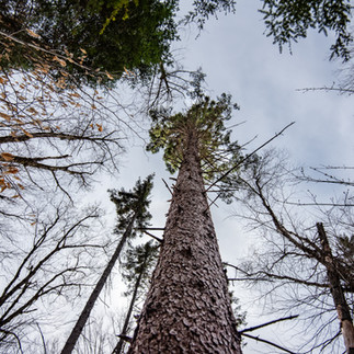
A relatively easy trail in Parc Eco Laurentides, the Tour de Lac Cordon, as its name implies, is a hike mostly near the lake shore. It’s a gentle hike with few up-hills, about 6 viewpoints, and more wooden bridges than we could count. Yet, these slightly worn down, almost mystical bridges gave access to parts of the lake we wouldn’t have otherwise been able to hike. The conditions were excellent. Very well marked and although a bit muddy, what's a trail without some mud? Early May… it’s to be expected. We did run into some people, but were mostly by ourselves the entire way. Signs of warmer weather were everywhere - flowers budding their little heads and all sorts of other plants sprouting; claiming their spot on the forest floor. Looking upwards, the first leaves budding from the trees were taking advantage of the sun’s rays on this particular morning. As were we.
The trail was a welcome discovery for us as it made us feel like we were far away from home. It made for the perfect combination - a mystical forest, yet a relatively easy (albeit long) hike to do with a small child.


2. Le Tour du Lac Trail, Mount Kaaïkop


Where in the World: Ste-Lucie des Laurentides, Qc, Canada
Name of the Trail: Le Tour du Lac -> Mont Kaaïkop
Trail level: Hard
Route Type: Loop and Out & Back
Length: 7.63 km
Time in nature: 4:25:06
Moving time: 2:03:24 pace 16:10 m/km
Elevation gain: 405 m
Altitude: from 413 m to 782 m


Trail Conditions:
- well maintained
- maps along the way
- bridges along the path
- muddy
- lake views
- rocky
- straight up and back down
- bathroom accessible at park entrance
Location:
3565 Chemin du Lac-Legault, Sainte-Lucie-des-Laurentides, QC J0T 2J0
Where to Park:
parking lot accessible at the entrance of the trails.
Fees:
cdn$9 at the park reception

What really happened out there!
The hike up Mount Kaaikop was awesome. Blue sky, perfect cool hiking temperatures and no mosquitos. Over 7 km of hiking, one of the longer trails we’ve managed with N. and actually at a decent pace! The hike was definitely hard - a steep, rocky incline for much of the way - but so worth it. One quarter of the way up there was a viewpoint (if you’re taking kids, hold their hands here. 100%), which gave us just a taste of what was to come. No mosquitos meant we could have a relaxing picnic on the way and take breaks.
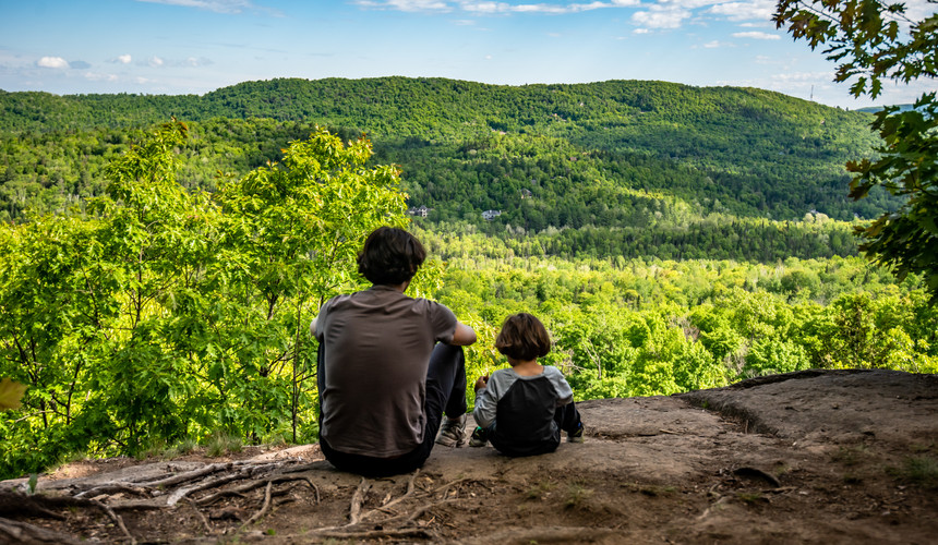
After a 400 meter ascent to the summit, everyone’s eyes just couldn’t open wide enough to take it all in. What a treat. We’ve explored so many trails from inside the forests of the Laurentians, that seeing the whole region from above - all that life below us! - was the perfect reward for the effort we made.
If you’re in the area, make some time - you won’t regret this hike.


3. Cap aux Bleuets Trail


Where in the World: St Faustin Lac Carré, Qc - Canada
Name of the Trail: Cap aux Bleuets
Trail level: Moderate
Route Type: Out & Back
Length: 2.38 km
Time in nature: 1:26:58
Moving time: 42:46 pace 17:56/km
Elevation gain: 155 m
Altitude: from 301 m to 449 m


Trail Conditions:
- moderately maintained
- poorly marked
- narrow path
- view point
- rocky
- straight up and back down
Location:
Coming from route 117:
Once you arrive onto Chemin de la Sauvagine, drive for 17km. Turn left onto Ch du Lac Sauvage. Entrance of trail is approximately 5.2km from the entrance of Chemin du Lac-Sauvage, Saint-Faustin-Lac Carré.
Where to Park:
Parking on the gravel road that gives access to the trail.
Fees:
no fee

What really happened out there!
What a hike! A direct 1 km uphill climb with 155 meter elevation gain to get to this great little viewpoint. Quebec has its hidden gems, that’s for sure. We love getting to viewpoints where everything is green for as far as the eye can see.
The Cap aux Bleuets trail was a welcome surprise and definitely a hike we'll do again. This kind of trail suits us perfectly - it gets our heart rate going enough to be considered a great workout, offers the perfect resting place with a stunning view and a consistent downhill to get back to the car before the little one can even start to complain!
So yes, overall we can say if you’re looking for a trail to go with your family for shorter distances, this one is a find!


4. Tour de Lac Trail, Alfred Kelly Nature Reserve


Where in the World: Alfred Kelly Nature Reserve - Prévost, QC, Canada
Name of the Trail: MOC Trail → Tour de Lac
Trail level: Easy-Moderate
Route Type: Out & Back and Loop
Length: 4.10 km
Time in nature: 1:57:49
Moving time: 1:08:52 pace 16:49
Elevation gain: 156 m
Altitude: from 185 m to 241 m


Trail Conditions:
- well maintained
- well marked
- wide path
- bridges along the path
- lake views
- rocky
- ups and downs
Location:
1272 Rue de la Traverse, Prévost,
QC J0R1T0
Where to Park:
parking lot accessible at the entrance of the trails and L'ptit train du nord.
Fees:
no fee

What really happened out there!
The tour de Lac Paradis brought us to an enchanted lake, a magical spot really. It might not have seemed so enchanted if we had managed to leave early like most people. =) But we got to a late start to say the least. And the truth is, that leaving a bit later when hiking popular spots is actually not a bad idea (even if we don’t do it on purpose). So it is worth mentioning that this trail seems like it would have had significantly more traffic on it earlier in the day, especially on weekends.
The trail itself was welcoming with wide passages and well marked terrain and yet when we looked around, we were surrounded by an impressive forest. After 1.5km we were greeted by a small lake (or very large pond) surrounded by rocky cliffs. The lake was clearly so full of life - we saw ducks, heard frogs and even, after walking a bit more, came across a beaver letting us know that the bridge we were crossing.. was actually his.
This incredible network of trails, part of the Alfred Kelly Nature reserve in Piedmont/Prevóst may not be as isolated as some of the trails we’ve hiked, but it somehow managed to offer an incredible escape into the wild.


5. Contre Courant Trail, Mont Tremblant Park


Where in the World: Mont Tremblant, Qc - Canada
Name of the Trail: Contre Courant
Trail level: Easy
Route Type: Out & Back
Length: 4.71 km
Time in nature: 1:54
Moving time: 1:07:31 pace 14:20 m/km
Elevation gain: 46m
Altitude: from 248 m to 233 m


Trail Conditions:
- well maintained
- very well marked
- maps along the way
- wide path
- bridges along the path
- river views
- bicycle traffic
- bathroom (check availability due to COVID 19)
Location:
On Montée Ryan road, stop on the right hand side BEFORE the bridge Pont Beauvallon to enter a small parking lot.
Where to Park:
small parking lot accessible at the entrance of the trails. 5 cars maximum.
Fees:
payment contribution 'trust based' - box on the trail

What really happened out there!
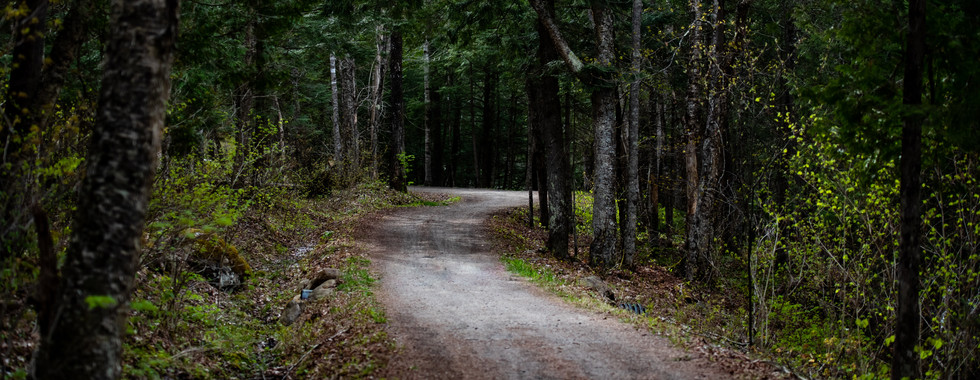
This trail in Mont Tremblant Park was more like an easy stroll through the woods on a gravel road. The river accompanied us in a constant hum and the occasional mountain bike zoomed past us. Perfect for a stroll as a family, this was more of an easy nature walk than a hike and just the right distance for walking with a small child. The whole path was actually a gravel road that curved along the Devil's River which offered different access points to bike trails along the way. Although not highly trafficked when we went, there are probably more bikes on the weekend so that is something to pay attention to. Just one of the many trails offered in this impressive region of the Laurentians, Mont Tremblant Park is probably the most famous of the area and truly has much to offer. Between the river and the mountains around, it's worth coming back to more than once.


6. Canadienne Trail


Where in the World: Ste Adolphe d'Howard, Qc - Canada
Name of the Trail: Canadienne -> L'Épinette
Trail level: Moderate
Route Type: Loop
Length: 3.06 km
Time in nature: 1:54:06
Moving time: 50:24 pace 17:08
Elevation gain: 90m
Altitude: from 398 m to 504 m


Trail Conditions:
- moderately maintained
- well marked
- maps along the way
- narrow path
- muddy
- stream views
- ups and downs
Location:
Montée du Val-de-Loire, St. Adolphe
Where to Park:
There is a small parking lot accessible at the entrance of the trails. 5 cars maximum.
Fees:
Payment contribution 'trust based' on the way

What really happened out there!
The Canadienne trail in Ste Adolphe felt like an enchanted forest, especially in the rain. The leaves were already growing in significantly, but there was still room to see through the trees. There were large, delightful sections of plush mossy forest floors. Even with our boots on, we could feel the soft welcome! (If you’ve ever stepped on moss, you know what we mean.) The trails were easy to navigate but because it was the beginning of the season, it was clear that the trail had had very little use. Also, there were different options within the trail network which is always good when you have a small child (just in case you need to abort the mission). When you have a network of trails, you can choose different variations of routes, step through different terrains and wide or narrow passages. At least on this trail. Although the trail doesn't offer many viewpoints, there was enough magic in this forest that we think it’s a shame to not tell you about it.


7. Pierre Gariépy Trail, Parc Regional Val-David-Val-Morin


Where in the World: Val Morin, Qc - Canada
Name of the Trail: Piste Gilles Leroux -> Pierre Gariépy
Trail level: Moderate
Route Type: Out & Back
Length: 5.03 km
Time in nature: 2:24:27
Moving time: 1:20:49 pace 16:04 m/km
Elevation gain: 157 m
Altitude: from 324 m to 423 m


Trail Conditions:
- well maintained
- very well marked
- maps along the way
- view point
- rocky
- ups and downs
- bathroom (check availability due to Covid 19)
Location:
Parc Regional Val-David-Val-Morin, QC, J0T2R0
Where to Park:
parking lot accessible at the entrance of the trails. We parked in Val-Morin and acessed the trail via Piste Gilles Leroux and L'Ptit Train du Nord.
Fees:
contribution at the entrance of the park (trust-based)

What really happened out there!
We always say that we love hiking because of the speed (or lack thereof) which allows us to pay attention to the details on the trails and also create games along the way.
We connected to our trail via the Piste Gilles Leroux, a gravel path that leads to the P'tit Train du Nord which we cross to enter the Pierre Gariépy trail. As soon as we entered the actual trail, the atmosphere changed. The trail we chose was full of rocks and roots that made it quite technical yet totally doable. It offers just enough obstacles to awaken small kids’ senses and keep them sharp. And well, ours too.
The pace was slow and careful and brought us to a beautiful viewpoint. After reaching the viewpoint, we had our picnic, played on the massive boulders that made up the viewpoint and started our return. This is a fun hike to do with or without kids, and you can go as far as your legs will take you. Parc Regional Val-David Val-Morin is a huge network of trails for all levels. This is just one of many, but definitely worth the visit!


8. De la Grande Ascension Trail, Parc de la Riviére Doncaster


Where in the World: Parc de la Riviere Doncaster - Ste. Adèle, QC, Canada
Name of the Trail: De la Grande Ascension -> L'Esquive -> Du Grand Remous
Trail level: Moderate
Route Type: Out & Back and Loop
Length: 5.74 km
Time in nature: 3:07:48
Moving time: 1:37:22 pace 16:57 m/km
Elevation gain: 200 m
Altitude: from 237 m to 370 m


Trail Conditions:
- well maintained
- very well marked
- maps along the way
- river views
- view point
- ups and downs
- bathroom (check availability due to COVID 19)
Location:
4672 Chemin de la Doncaster, Sainte-Adele, QC J8B1R8
Where to Park:
parking lot accessible at the entrance of the trails.
Fees:
cdn$8 contribution at the entrance of the park

What really happened out there!
This beautiful trail offers a bit of everything - a consistent uphill to get your blood flowing, a viewpoint overlooking the vast greenness of the Laurentian mountains (with a lovely bench should you want to sit down and take it all in), thick forest all around, and to top it off, the sound of rushing water accompanying your steps as you descend and start walking along the river.
It's in a popular area so there will be other people hiking, but it's still worth the trek. At least we think so! :) The river was really impressive and there are a few spots along the way where you can really immerse yourself in her sounds and movement. Even if there hadn't been a beautiful view (which there was!) the river itself made it worth it!


9. Inter Villages Trail, Parc Regional Val-David-Val-Morin


Where in the World: Val Morin, Qc - Canada
Name of the Trail: Inter Villages -> Gélinott
Trail level: Moderate
Route Type: Out & acB
Length: 2.64 km
Time in nature: 1:55:38
Moving time: 48:33 pace 18:22 m/km
Elevation ga 148 m
Altitude: from 330 m to 442 m


Trail Conditions:
- well marked
- narrow path
- well maintained
- lake views
- view point
- bathroom (closed due to COVID 19)
- payment at registration 'accueil'.
Location:
Parc Regional Val-David-Val-Morin, QC, J0T2R0
Where to Park:
parking lot accessible at the entrance of the trails.
Fees:
cdn$8 contribution at the entrance of the park (trust-based)

What really happened out there!
The network of trails in Parc Regional Val-David-Val-Morin offers a beautiful variety. Sometimes we go just to immerse ourselves in the forest with no particular destination, other times we hike with the intention of getting to a viewpoint. This particular hike, the Inter Villages trail to Gellinot was a steady uphill, that brought us to a beautiful viewpoint overlooking Val Morin. The roots and rocks along the way offer an added adventure for small kids and... for the adults as well (perhaps in a different way)! We had a fun time climbing through the moderate obstacles to get to a worthy destination.


10. Panoramique Trail, Parc Éco Laurentides (CTEL)


Where in the World: St Faustin Lac Carré, Qc - Canada
Name of the Trail: Panoramique
Trail level: Moderate
Route Type: Out & Back
Length: 3.51 km
Time in nature: 2:15:26
Moving time: 1:03:47 pace 18:10 m/km
Elevation gain: 177 m
Altitude: from 352 m to 515 m


Trail Conditions:
- well maintained
- well marked
- maps along the way
- narrow path
- view point
- bathroom (check availability due to COVID 19)
Location:
5000 Chemin du Lac Caribou, Saint-Faustin-Lac_Carré, QC J0T1J2
Where to Park:
parking lot accessible at the entrance of the trails.
Fees:
cdn$8 contribution at the entrance of the park (trust-based)

What really happened out there!
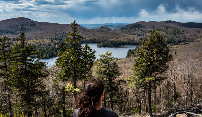
We decided to return to the Eco Parc Laurentides to see the lake we had previously looped, but this time from above.
The Panoramique trail, as its name implies, brought us to a spectacular viewpoint after a relatively steep climb - we gained 177 meters in the first 1.5km. There were definitely a few spots where we needed to give N. some extra attention. (It’s so hard to find a balance between letting the toddler roam freely and making sure he doesn’t fall into oblivion, don’t you think?) Overall it was a steady uphill until we got to the spectacular view of Lac Cordon.
The trail is maintained, yet definitely not easy. We winded through the forest, passing incredible tree roots, tiny chipmunks, massive trees, and singing birds. It’s the kind of trail that fulfills many of our ‘pre-requisites’ for awesome trails. It’s decided - we love this park.
We love the trails here. And we love the view! Do yourself a favor and go.


Comments